Walk from Torrisdale Bay to Invernaver
Distance of 4 Miles, Total Ascent 406ftCome unto these yellow sands
And take hands.
OS Grid Reference: NC 681 612
Torrisdale Bay to Invernaver
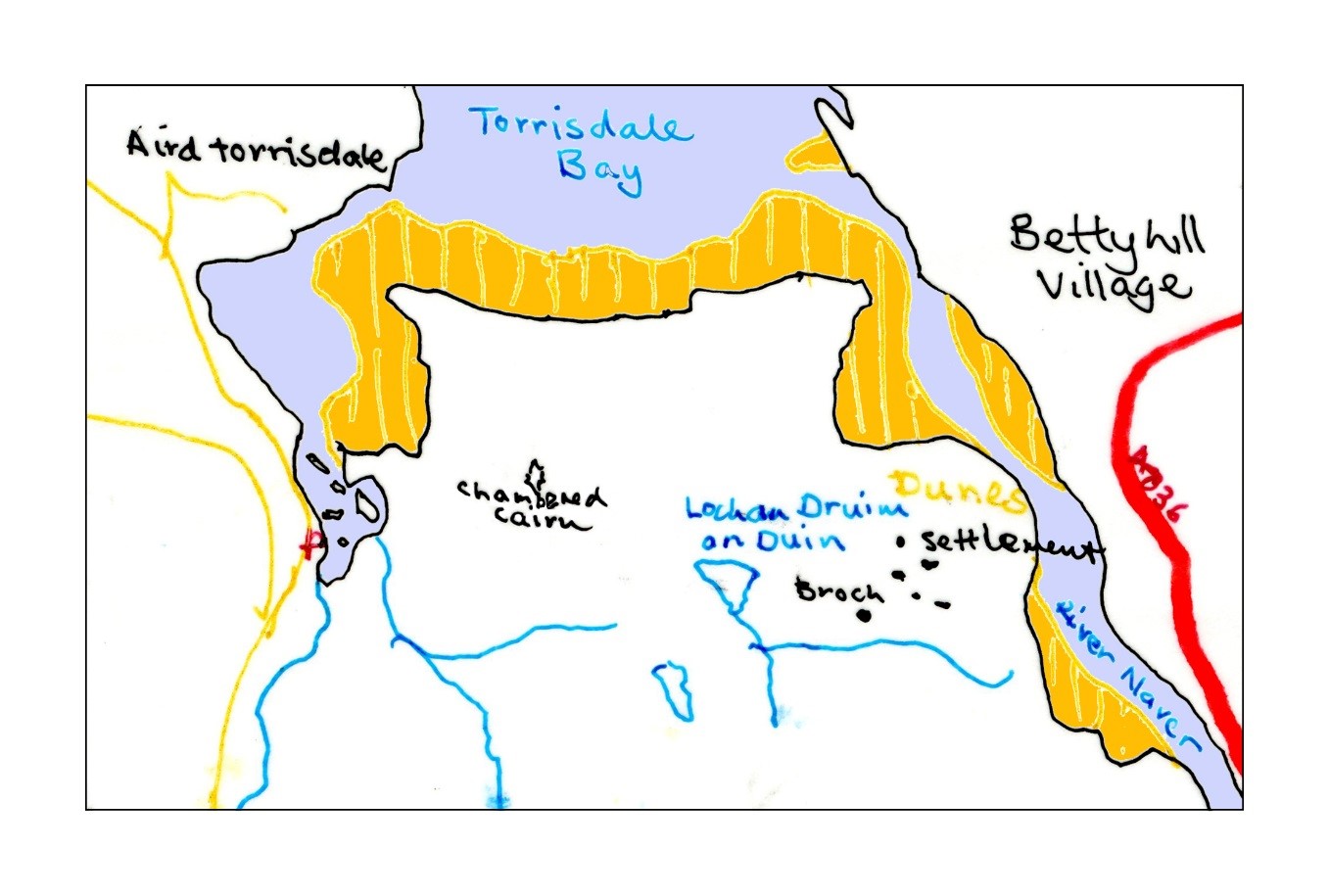
Drive to Borgie five miles west of Bettyhill. Turn down the Skerray road past several houses and the Borgie Lodge. After a while the sea comes into view and a footbridge that crosses the burn below the road. Just after the signpost to Torrisdale there is a wider part of the road with an information board where you can park (picture above). Go down the bank and cross the burn by the footbridge. Follow the line of telegraph poles up the other side and over the hill. You will pass a small lochan which may well be inhabited by water birds. You may wish to venture to your right into the nature reserve marked on the map. Here you will see many unusual flowers, alpines and mountain avens growing on the exposed rocks. Return to the line of poles that will bring you to the top of a gully where a burn gathers water and there is a safe descent down the escarpment that overlooks Invernaver. Over the top of this gully, buzzards are often seen circling in the thermals. To your left near the top is a ruined broch. From it you can look down to the raised beach area below and see the hut circles of a Neolithic settlement which are interesting to visit. You can either walk left through the dunes to the shore or go straight on to the river’s edge. From here you may see, or more likely hear, salmon leaping as they first encounter fresh water after their epic Atlantic journey. Evidence of otters may also be seen. Follow the river to the sea then walk round the magnificent sands of Torrisdale Bay westward to where you can re-cross the burn and re-join your car.

